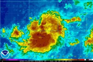
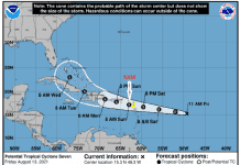
On this Sunday, NHC is monitoring a tropical wave accompanied by a surface low pressure system over the far eastern Atlantic Ocean a few hundred miles south-southwest of the Cape Verde Islands.
Environmental conditions are expected to be somewhat conducive for gradual development of this disturbance over the next several days while it moves westward.
Get the latest on the tropics anytime by visiting the NHC website at www.hurricanes.gov
###
 TROPICAL WEATHER OUTLOOK NWS NATIONAL HURRICANE CENTER MIAMI FL 200 PM EDT SUN AUG 16 2015
For the North Atlantic…Caribbean Sea and the Gulf of Mexico:
A tropical wave and a surface low pressure system located several hundred miles southwest of the Cape Verde Islands are producing a concentrated area of showers and thunderstorms, which are beginning to show signs of organization.
Environmental conditions are expected to be conducive for further development, and a tropical depression could form by midweek as the disturbance moves westward at around 15 mph.
* Formation chance through 48 hours…medium…50 percent
* Formation chance through 5 days…medium…60 percent
$$ Forecaster Stewart


