Global Weather Oscillations (GWO) was cited by news media as the only major hurricane prediction organization that correctly predicted the hyperactive 2017 Atlantic hurricane season from beginning to end, and the destructive United States hurricane landfalls.
The media also noted that when the hurricane season began last year, “nearly every major weather agency predicted a normal 2017 hurricane season – but only Global Weather Oscillations Inc. (GWO) had an accurate forecast” – with a prediction for a destructive hurricane season with 16 named storms, eight hurricanes, four major hurricanes – and 2 major impact hurricanes for the United States.
GWO also predicted the United States would have 6 named storms and 3 hurricanes making landfall in 2017 – and where they would occur. Just as predicted, the U.S. ended up with six named storms and 3 hurricanes. GWO predicted that the Florida Peninsula would break out of their 12-year hurricane drought with a major category 3-4 hurricane making landfall on the south tip of Florida. GWO also predicted that Texas could break out of their 8-year hurricane drought with a landfalling hurricane just above Corpus Christi – and a Category 1 hurricane striking the upper Gulf Coast. The 2017 landfalling hurricanes ended up being – Harvey, Irma and Nate.
Professor David Dilley – senior research and prediction scientist for Global Weather Oscillations – prepares hurricane and tropical storm predictions for 11 zones stretching from New England to Texas. By using Climate Pulse Technology developed by Mr. Dilley, GWO can issue accurate zone predictions for release in January – well before the beginning of the hurricane season.
Professor David Dilley, states that the “Climate Pulse Technology Model” is based on natural rhythm cycles that control hurricane landfall cycles and the position of the Bermuda High Pressure Center. By utilizing this technology, GWO has issued the most accurate predictions by any organization during the past 10 years. The preseason zone predictions are so accurate – updates to the forecasts are not required during the hurricane season. Although GWO does offer special weekly hurricane outlook webinars and tracking webinars when a storm may threaten the United States. GWO is a working partner with the International Hurricane Protection Association – INHPA.
More information is available via GWO’s preseason hurricane webinars and their detailed hurricane zone predictions at GlobalWeatherOscillations.com, or GlobalWeatherCycles.com
—- Prediction: 2018 Atlantic Basin Hurricane Season —-
(which includes the Caribbean Sea and Gulf of Mexico)
As predicted by Mr. Dilley and GWO – last year (2017) was the costliest year on record for the United States, and one of the most destructive. Mr. Dilley says that “some United States zones are currently in their strongest hurricane landfall cycle in 40 to 70-years.” This is a Natural Climate Pulse Cycle that produced extremely active and dangerous hurricane conditions in some zones back in the 1930s and 1940s – and is now repeating.
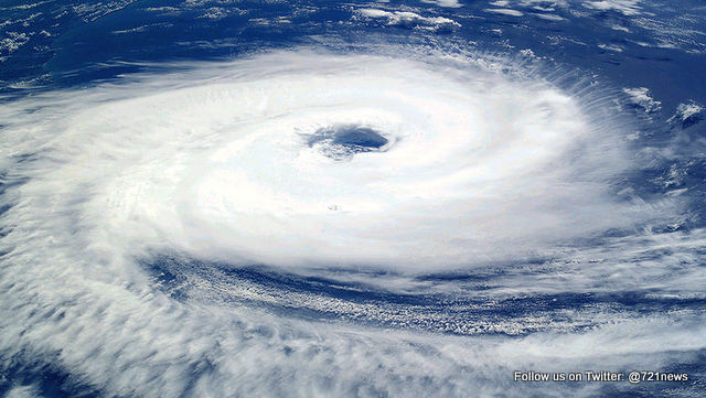
Mr. Dilley predicts that 2018 will be somewhat of a repeat of 2017 – and possibly another record breaker. Although it will be strikingly similar to last year- some hurricane landfalls will occur in different locations this year. You can expect 16 named storms, 8 hurricanes, 4 major hurricanes, potential for 4 United States hurricane landfalls – 2 of which will likely be major impact storms. There is the potential for 6 named storms making United States landfalls. On the average, the entire Atlantic Basin has 12 named storms, 6 hurricanes and 2.7 major hurricanes.
The reason for another destructive hurricane season is 3-fold. The ocean water temperatures continue to run warmer than normal across most of the Atlantic Basin (red and orange in the graphic), and especially in the Caribbean region and the Atlantic near the United States. This is very similar to the ocean temperatures of last year, and this will again be conducive for tropical storms and/or hurricanes forming and/or strengthening close to the United States. Mr. Dilley also expects the Bermuda-Azores High Pressure Center will again be in a favorable location – thus allowing more named storms to maintain strength – or strengthen as they move from east to west across the Atlantic toward the United States.
Then we come to the last item – El Niño. GWO’s Climate Pulse Technology model indicates that the Tropical South Pacific Ocean temperatures where El Niño events typically form – will warm significantly during late winter and approach weak El Niño conditions during the spring- much like the El Niño scare of last year. However, all years are not the same – therefore it could mature enough to form a very weak El Niño, but not strong enough to dampen the hurricane season. Historical records indicate that moderate to strong El Nino events dampen hurricane activity – whereas years with very weak El Niño conditions can be associated with active hurricane seasons if a Climate Pulse Hurricane Enhancement Cycle is in place – and it is.


